


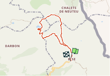

9,2 km | 22 km-effort

Utilisateur


Application GPS de randonnée GRATUITE
 SityTrail
IGN / Instituts géographiques
SityTrail World
Le monde est à vous
Randonnée Marche de 8 km à découvrir à Auvergne-Rhône-Alpes, Haute-Savoie, La Chapelle-d'Abondance. Cette randonnée est proposée par Glaf21.
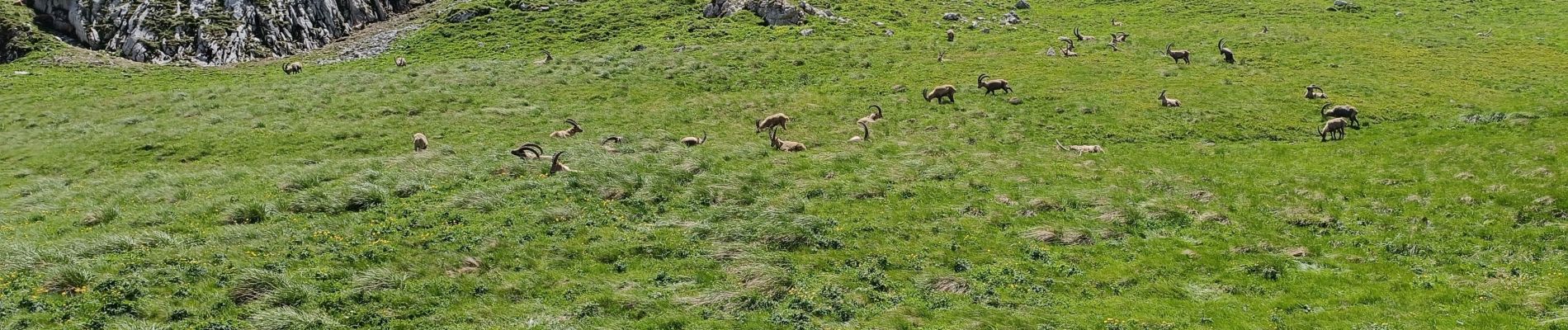
Très belle balade sans difficulté au milieu des bouquetins. Pour ceux qui ne craignent pas le vide, il faut ajouter la boucle par la dent du Velan et le col d'Ugeon.


Marche

Marche

Marche

Marche
Marche

Marche

Marche

Marche
Marche